


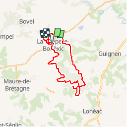
SityTrail - 18/02/2017 -.LA CHAP.BOUEXIC.Nord et Sud.Virtuel

chasle
User

Length
29 km

Max alt
114 m

Uphill gradient
467 m
Km-Effort
36 km

Min alt
32 m

Downhill gradient
464 m
Boucle
Yes
Creation date :
2019-05-31 22:40:40.606
Updated on :
2019-05-31 22:41:43.267
7h45
Difficulty : Very difficult

FREE GPS app for hiking
 SityTrail
IGN / Geographical institutes
SityTrail Plus
The world is yours!
About
Trail Walking of 29 km to be discovered at Brittany, Ille-et-Vilaine, La Chapelle-Bouëxic. This trail is proposed by chasle.
Positioning
Country:
France
Region :
Brittany
Department/Province :
Ille-et-Vilaine
Municipality :
La Chapelle-Bouëxic
Location:
Unknown
Start:(Dec)
Start:(UTM)
579097 ; 5308964 (30T) N.
Comments